Kruja General Info
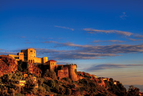
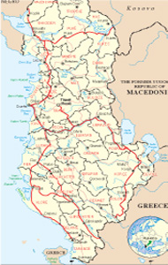
Kruja is an important center of tourism in Albania. It is a typical tourist destination that regards you in a slope of the mountains of Kruja and can easily be seen along the national road Tirana-Shkodra. It lies 20 km in the north of the Albanian capital. The name "Krujë" thought to have origin from the word "source" (water source), because there are many sources in Kruje. Kruja residents call their city and water resources with the same name "Crua. The town lies in a mountain site, donating an overview of respective beauty. The district links in the West with district of Durres in the South with Tirana, in the East with district of Mat and in North with the district of Kurbin. It has two municipalities and four communes.
Climate
Characterized dy mountainous Mediterranean climate with cold winter and cool summer. Rainfall is mainly present as rain but the snow is included too. Average temperatures vary between 10-14 degrees Celsius in winter and 25-30 degrees Celsius in summer.
History
Kruja is a very ancient settlement dating back three centuries before Christ. Two Illyrian tribes, lived in towns Brysaka and Albanopolis. Albans were exactly the Illyrian tribe that gave the name Albania to the country, the name by which is also known in the world. In a map of Illyria and the Balkan peninsula, Ptolemy has also signed Albanopolis, as the capital of the Illyrian tribe of Albans. The tribe under the pressure of wars gradually withdrew from the city in the settlement of Kruja today, and changed gradually even his name, which by Alban, turned Arber, and Albania by Albania was called Arbëri. In the world she still was called Albania, as well known today, while Albania itself, wasn’t eventually stabilized her name. Kruja can be called one of the cities with a rich history in Albania. From there begins the story of Skanderbeg's our legendary leader, and many other feudal princes, who possess different regions of Albania, century after century and wrote the pages of history at the time of the Ottoman conquest. Kruja is the city that has undergone three large enclosures by the Turks, the sultans and their children (Murad, Mehmood etc.), more attacks by foreigners that took place one after another after the Turkish invasion. Even during the Second World War, Kruja recorded a series of important battles.
Culture and ethnography
The city is rich in monuments of culture and ethnography, because of his history, even is also a rich archaeological area. Kruja is declared "hero city", and "museum city", as it bears invaluable asset and is one of the most famous Albanian cities in the world, even during the period of isolation. The castle of the city and its historic museum, are definitely the two most important objects, leaving no outside attention the characteristic street of the Old Bazaar, the Ethnographic Museum, etc.. But a number of objects of worship, inspire great interest to visitors, as reflective of an unprecedented religious harmony, as happens in almost all cities of Albania. Kruja has issued a number of other famous personalities like Karl Topia, a former prime minister as Mustafa Kruja, even well known Italian singer Ana Oxa, is originally from Kruja. Kruje's rich in cultural spiritual and material values, ranging from clothes, characteristic handicrafts, the works in copper, gold and silver, houses and roads feature, rich in folk music and dance, painting etc..
What to visit in Kruja
The city is all to visit because it is collected and provides a full walk. But of course you can not leave Kruja without visiting its Castle, which is closely related to Scanderbeg, and bazaar that is an original piece of history and civilization. We would suggest also religious objects as the Sarisalltikut Tekke, Varosh Mosque, the Dollma Tekke, located near the Castle etc. An invaluable natural resource of this district is definitely Qafshtama
National Park.
The old city of Albanopolis
One of the last discovering archaeological sites, is in the matter of facts the oldest settlements of Albanian tribes, who have given the name to the later Albania. The tribe of Albans, lived in Zgerdhesh, or Albanopolis, a very developed city, known as a strategic point of the period when it was founded. The Illyrian city of Zgerdhesh is not mentioned in ancient literary or historical documents, as such, although many scholars believe that it was the city of ALBANOPOLIS mentioned by Pliny. Archeological investigations have shown that settlements on the site at the base of the Kruje began in the VII-th century or VI-th century BC, when an acropolis covering about 1.3 hectares was enclosed with walls. In a second construction phase, a much larger area was enclosed, covering over 8 hectares, with the walls totally around 1400 m in length. A series of defensive towers was built around the perimeter at this stage.
The city seems to have flourished for 300 or 400 years before being largely abandoned in the II-nd century BC, and the inhabitants moved to Dyrrachium or Lissus. Some evidence of settlement has been found going up to the VI-th century, when Kruja came to dominate completely the surrounding district.
National Park “The pass of Shtama”
In general the view of this Park is 360 degree and picturesque. On the north border there is a recreation center. Attention is paid to the development of tourism where attractive are the lakes situated near the Park, at its northern part. The area is characterized from continental climate with fresh summer and cold winter but not always snowy. The degrees go under zero. Very big diversity of the species and at the same time, high tourist-re creative values . The park is covered from pine and beech. It’s famous the Black Pine, characteristic of this park, in many exemplars of an 50-60 years of age,, about 20 m high and 30-40 cm of diameter. The fauna is rich of brown bear, wolf, fox, lutra-lutra etc. There are possibilities here for developing the echo-tourism, curative tourism (for diseases of respiratory ways), climbing etc. Hunting (during the season) and camping are aloud but you should ask authorization next to the park’s authority about the allowed areas.
What to visit
“The fountain of Queen Mother”, next to the Park, with pure water, cold and curative, 1100 m on the sea level. The name comes from the years ‘30 because there was the place where the royal family use to furnish with water. Every day a track use to do the itinerary Tirana-Shtama Pass. The source has curative values and the landscape around is amazing. Near of this fountain is built a Climatic Center for bronchial problems. Can be visited going by the road Krujë-Qafë Shtamë. We recommend also the Gorge of Zeza, situated on the valley of Zeza, The Rock of the Crying, situated on the north of Kruja, in the highest peak of the mountain of Kruja. 1 km long, 4-5 m wide and 200 deep. The legend says that from the top of this rock fell down 90 girls and women in the way that the Turkish solders couldn’t catch them durind the evasion of Kruja in 1478.
The cave of Sarisalltiku, situated in the east of Kruja, used like a religious cult object for the bektashian muslims. It is 10-15 m deep and 3-4 m high. There is a fountain inside and some stalactites and stalagmites. Can be visited going by the road Krujë-Sarisalltik.
Food and accommodation
Going to Krujë and Qafë Shtamë you will find traditional restaurants which offer you the cuisine of the zone. Because of the mountain nature the preferable food is the lamb in spit and the brandy made home (Rakia). Inside of Kruja there are many nice places where you will enjoy all the Albanian dishes, also different dishes of the international cuisine. The accommodation is only in the town and in some winter residences of the park, which offer you optimal standard and necessary conditions
The natural monuments
Geo-monumnets
The Gorge of Zeza, in the valley, separates the mount of Gamti from Kruja, over 1 km long, quite close, about 200 m deep, is formed in antecedence by the water erosions in limestone rocks. Creates very attractive landscape for picnics. Tirana-Zallher rural road.
The Gorge of Vaja, or the Rock of Vaja. in the northern side of Kruja city, in Mali's northern edge Kruja. On the left slope passes the rural road Kruje-QafëShtama. It is formed by the river of Droja antecedence in limestone. 1 km long, average width of 5-6 m and 200 m depth. The legend says about this gorge that after the invasion of Kruja on June 16, 1478, 90 the women and girls of Kruaj, not falling into hungry hands of the Turks, were fell down the rock from 200 m of height. The road-rock of Vajës Kruje itinerary.
Sarisalltik. Kruja, a few meters down the flat peak of the mountain of Kruja, where is the cave of Sarisalltiku, use for long time as Bektashian cult temple. It is about 10-15 m deep, high up to3-4 m. Inside is a water source. Stalactites and stalagmites are damaged, not to purpose from the believers. It is visited by many residents of Kruja and its surrounding by the rural road Sarisalltik-Kruje.
Hydro-monument.
The source of the Queen Mother, about 100 m above sea level, between the pine forest of the National Park Qafeshtama. The name was give in the '30s, because of the water, which use to be taken from the royal family of King Zog, The panorama around the forest, amazes every visitor. Very close to, lies the Curative centre for the lung diseases and a plant for drinking water "Qafshtama. Kruje-Qafështamë itinerary.
Biomonuments.
The Plane-trees of Arramerasi.
The cypress-tree of Teke.
The Plane-tree of Taslloi.
The Plane-tree Ballabaneci.
The Black Pine-tree of Qafë Shtamë.





.jpg)
