Gjirokastra General Info
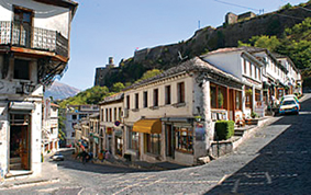
Situated in southern Albania, Gjirokastra perches on the steep side of the Drino valley overlooking an historic landscape framed by snow-capped mountains. This “city of a thousand steps” comprises hundreds of Ottoman-style tower houses with distinctive stone roofs, wooden balconies and whitewashed stone walls. Dominated by the sheer flanks of its vast castle, Gjirokastra is a magical city with a tumultuous past. From feudal stronghold to Ottoman jewel to Italian colony, the city has known many rulers and has inspired poets, authors and artists. Known by many as the City of Stone, Gjirokastra is a developing centre for cultural heritage tourism. A walk around the network of cobbled streets that climb steeply out of the bazaar will transport you back in time. A visit to the vast 13th-century castle brings the adventurous tales of medieval rulers and communist atrocities alive. There is much to see in Gjirokastra and the surrounding areas, and a stay in bed and breakfast accommodation in one of the converted Ottoman houses can make an excellent base for exploring the region.
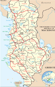
Gjirokastra District includes the town of Libohovë and communes of Antigone, Lower Dropulli, Upper Dropulli, Lazarat, Lunxhëri, Odrie, Picar, Pogon, Qendër Libohovë, and Zagori. Through the gorge of Këlcyrë the city is linked with other centers of southern Albania.
The majority of Gjirokastrans are ethnic Albanians with a minority of Greeks, as well as small communities of Vlachs and Romas.
Relief and climate
Gjirokastra is located 400 m above sea level. The climate is Mediterranean. The Absolute highest temperature was recorded during the years 1951-1960 has been 42.2 degrees awarded C, the lowest 8.4 degrees C.
The city’s name has either legendary or more mundane origins. Legend claims that during the final siege of the city by the Turks, Princess Argyro, the sister of the feudal lord of the town, despairing for her people, threw herself from the battlements together with her young son rather than be taken alive by the enemy. The name “the fortress of Argyro” comes from this (but since the first mention of the town’s name is in Byzantine records well before the Ottoman conquest, this seems unlikely). Another explanation is that the city takes its name from the Greek word for silver, argyrókastron – a reference to the grey stone walls, streets and roofs which shimmer like silver when it rains. Argjyri is also the name of a clan native to the Gjirokastra region, from whom the town’s name could also have been taken.
The modern city of Gjirokastra comprises the old town, a fortress (the original focus of the settlement), the Ottoman districts situated on the ridges leading away from the fortress and the new town on the valley floor where most modern buildings and the university complex are concentrated. The traditional quarters of the city radiate around the fortress: Cfakë, Dunavat, Palorto, Varosh, Meçite, Hazmurat, Pazari i Vjetër.
History
The early history of Gjirokastra is relatively unknown. Due to the proximity of the Hellenistic settlement Antigonea (near Jermë) and the Roman city of Adrianopolis (close to the village of Sofratike) it has frequently been assumed that the medieval fortress represents the first occupation of the site. However this has now been challenged by the results of excavations within the fortress that have revealed ceramics from four different phases of occupation before the Ottoman period: 5th -2nd-centuries BC, 5th -7th-centuries AD, 9th -10th-centuries and 12th -13th-centuries. The earliest of these phases also produced evidence of substantial block-built walls suggesting that there was a significant fortification on this side of the Drino valley in the pre-Roman period (before about 168 BC).
In 1811, the city fell into the hands of Ali Pasha of Tepelenë. He enlarged the fortress and constructed a 12-km aqueduct, which brought drinking water from Sopot Mountain. The stone aqueduct was the subject of a painting by the famous British artist Edward Lear who travelled widely in the region. The, by now derelict, aqueduct was almost totally demolished in 1932, but in the Manalat Quarter a small section still stands, known locally as Ali Pasha’s Bridge or Manalat Bridge. After Ali Pasha was killed by the forces of the Sublime Porte (the Ottoman Sultan and his court), the city continued as an Ottoman administrative centre and as a trading centre for local products including: livestock, wool, flannel, dairy products, silk, and embroidery.
During the early 20th-century Gjirokastra occupied an important location as the frontiers of modern Albania were being defined. The years under communism saw extensive industrialisation as well as substantial efforts to conserve the unique cultural heritage of the town (see separate section for more details). When the communist regime fell at the end of 1990, Gjirokastra’s economy was already declining rapidly. To achieve full employment, the communists assigned far more people to work in the already outdated and inefficient industrial complexes than were actually needed, and the collapse of the communist system resulted in the catastrophic loss of thousands of jobs in Gjirokastra. Thousands in turn migrated either to Tirana or abroad in search of work. In the civil unrest that followed the fall of the regime the National Armaments Museum was looted and the city’s enormous statue of Enver Hoxha was pulled down. The site is now the car park of a coffee bar and restaurant.
Gjirokastra began a slow climb out of the initial chaos of the communist collapse, only to fall again during the 1997 crisis that revolved around electoral fraud and the collapse of pyramid savings schemes where thousands lost their life savings. A significant part of the Bazaar was burned or otherwise damaged during this time, and the town suffered a state of siege as people struggled to survive in a violent and lawless environment. The crisis triggered another mass emigration, abandoning many historic buildings to decay and collapse. The days of the Museum City were long gone and the state was no longer able to exercise its legal obligation to fund the maintenance and conservation of
What to visit
The castle is open all year round (April to September 09:00 to 19:00, October to March 09:00 to 17:00 ) with an admission price of 200 Lekë. A small bar is situated within the ramparts where refreshments can be purchased.
The castle, which is undoubtedly one of the most magnificent structures of the city, sits on a rocky bluff with the city stretching out around it. It offers spectacular views of the Drino valley and surrounding mountains. The castle has undergone various additions and changes over the course of the centuries: The first major fortifications were built under the Despots of Epirus in the 12th and 13th centuries. After the Ottoman conquest of the late 14th century the most extensive improvements were made around 1490 by Sultan Beyazid II. From 1811, the Ottoman governor Ali Pasha of Tepelena added many elements, including the clock tower on the eastern side. He also completed fortifying the full area of the bluff. In addition he built an aqueduct to bring water to the castle from distance of over 10 km from the surrounding mountains. Since Ali Pasha’s time the castle has fallen into disrepair. In the 1930s it was redesigned as a prison by the Italians at the request of King Zog,
Things to see in the castle:
Bektashi Turbe (tomb)
Situated to the right about 50m inside the main gate you will see a small building tucked into the walls of the castle amidst a lovely garden. It contains the remains of two Bektashi Babas.
Artillery Gallery
Turning left from the main entrance, you will enter a long gallery lined with artillery pieces. All of these guns were either abandoned by, or captured from, the Italian and German occupation forces during World War II. Within this gallery there is also a small Italian tank built by Fiat.
National Museum of Armaments
Originally opened in 1971, the National Museum of Armaments is located in what was once the part of the prison. The current displays cover Albanian arms from independence in 1912 to the end of World War II, and most of the museum is dedicated to the Partisan struggle against the Italian and German occupation forces from 1939 to 1944.
For further information and a free leaflet call in at the Tourist Information Centre.
The prison
The entrance to the prison is in the first gallery of the National Armaments Museum. Completed in 1932, the prison was used by King Zog’s regime followed by the Italian and German occupation forces during the Second World War, and finally the communist regime until 1968. The only part of the prison that is accessible to visitors was developed as a museum by the communist regime in the 1970s. You may also gain access to the roof of the prison, going up the ramp situated to the right of the main gate.
The American Airplane
The remains of a United States Air Force T33 Shooting Star are exhibited on the ramparts overlooking the city. The airplane was forced to land at Rinas Airport, near Tirana in December 1957 due to technical problems.
Festival Stage
The stage was erected in the 1980s and has for some years been the home of the Albanian National Folk Festival, held every four years (last held in 2004). During the year the stage is used by the municipality on public holidays to present music and dance events.
Natural beauties
Gjirokastra unless it is a landmark for cultural tourism, also offers outstanding natural beauties, located mainly in the suburbs of the city and in its beautiful villages. Before you enter in the city, you will face the source of Viroi, a natural resource exchanged into a reservoir, which offers freshness and charm to the travelers that stop there. To make the most pleasant stay, a variety of restaurants and hotels are set up around the lake and within it.
Gjirokastra will amaze you with of its diverse areas of Zagoria, Pogoni, Kardhiqi, Glina, Libohov, etc., where the nature has expanded with big generosity, in wonderful landscapes.
The of Valley Zagoria
It lies between the mountain of Dhëmbeli and Lunxheria, divided by the valley of Pogoni through the hill of Sinori. It starts at the gorge of the Pass of Dhëmbeli and ends in the gorge of Këlcyrë. It is created in the Zagori-Pogoni sinclinal and consists of PG flysh deposits, which has conditioned the partition, of relief contrasts and spread numerous hot spots of erosion. Extends from about 150 m, at 1000 m above sea level. The beauty of this area is distinguished because of the green, old trees, hills, mountains etc. very famous village in Albania for its honey.
Pogoni Valley.
Pogoni Valley lies in the southeastern of the hill of Sinort; between Bureto and Nëmërçka mountains, mountain of Damaskinit (1433) and Makrikambos (1676) m, which close the valley from the south and connect Bureto with Nëmërçka. It is 15 km long and about 5-6 km wide. Flysch consists of PG, while the slopes of the Eocene limestone. The valley has developed in the southeastern continuation of Zagories sinklinal. Pogoni valley is distinguished for its various nature and the contrasts of a rare beauty, which is evident in every season.
The Valley of Kardhiqi
It is one of four strict nature preserves of our country. It is lied on Kurvelesh highland, divided with a hilly pass from the valley of Kalasa. The relief is characterized by various geographical elements, somewhere enlarged spaces and somewhere enclosed. In this sector is a sliding terrain as Zhulati one. In this section the valley expands, displaying some terrace and river levels, while the river itself branches. In the central part of the valley is created the field of Kardhiqi, flat, 1.5 km long and 1.3 km wide. Surrounded in north and south from a the hilly ridge flysh relief. Very attractive area, for the lovers of nature, to organize picnics, long walks, camping, etc.
The fir of Sotira
Situated in the district of Gjirokastra, at the same region. The long distance from the national road makes it a quiet place, with high diversity of habitats and kinds. It presents considerable values at the scientific and tourist point of view. We can mention Junglo-Plantanetum orientalis, accompanied from the presence of Crataegus monogyna, Rubus ulmifolius, Sanguisorba minor et. It is a protected area. Very interesting rests also Abies borisii-regis (Huetio-Abietum). This diversity, the clean air, the hydrographic heritage, grows up the eco-tourist values.





.jpg)
